
| |
| Sawtooth Ridge photographed from Bridgeport; photo and labels by Fred Hochstaedter |

On the other hand, there are enough diversions on this trip to stretch it out to four days. Numerous peaks, bowls, and passes surround you, tempting you to climb, traverse, or just to hang out and gaze.

| |
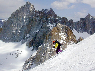
| Lucy O'Brien descending Mt. Eocene; photo by Fred Hochstaedter |
Nearly everyone coming to ski the Sawtooths ascends towards Matterhorn Peak via the Horse Creek trail. Popular routes to the peak include the East Couloir just left of the summit massif, the hourglass-shaped slope left of that known as Skiers Dream, and the easier but less direct Horse Creek Pass route.
However, I'm going to describe a loop tour, which goes in via another canyon to the west, and follows the crest eastward to near Matterhorn Peak, returning to the trailhead via the Horse Creek trail. This loop could be done in either direction; I like the direction that I will describe mainly because I prefer to make the main camp in the less heavily used Blacksmith Canyon.

| |
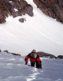
| Cathy Bianco ascending into upper Avalanche Canyon |
At around 8200', start to climb ledges northwest of Blacksmith Creek. Hopefully you'll be on snow here, or soon above here. At 8400', you'll pass the departure point for 11581' Mt. Walt, a peak that boasts an excellent ski descent off of its north-facing summit ramp. Continue upcanyon until you reach Glacier Lake, our mid-tour camp. If you have time, consider a day-tour from Glacier Lake up to the summit of the round-topped Mt. Eocene (like Mt. Walt, this peak is also marked 11581' on the 15' topo map).
From Glacier Lake, you can continue the loop tour by ascending southeast to the 10850' pass north (left of) the monolithic triangular mountain, Blacksmith Peak. From this pass, you will need to descend about 100', then traverse about 100' to the east, and then ascend, steeply at first, about 200', reaching the spectacular upper bowls of Avalanche Canyon. Contour eastward to the obvious break in the striking side-ridge known as The Cleaver, which is briefly quite steep on the eastern side.
Once east of The Cleaver, contour southeast for about a half-mile, looking for the 10800' break in a line of rock bluffs, staying around 10800' after that until you pass south of a pointy rock formation. Go ahead and follow the drainage down from there (unless you want to go play on or near Matterhorn Peak, in which case you should try to stay high), traversing a little eastward around 10000' to avoid some steeper stuff. By that time, you'll probably be able to see the range of descent options, some of them with plenty of ski tracks.
If you run out of snow at around 8000', look for the trail which descends along Horse Creek's east side.