| |
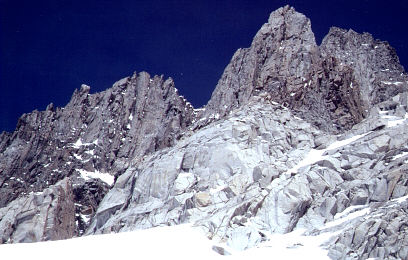
| The west side of the North Palisades group |
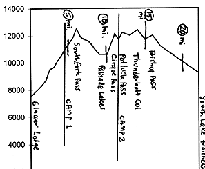
Start at the Palisades/ Glacier Lodge/ Big Pine Creek trailhead west of Big Pine, and work your way up the South Fork Big Pine Creek route. This route includes some pretty steep terrain relatively low down; if ascending, you'll want to start up early in the day to avoid the dreaded bottomless slush that can make some of these lower slopes slow and hazardous. Below Willow Lake, it's probably best to roughly follow the trail route, though some people bushwhack up or down NW of the creek. At 10300', continue south rather than dropping east to Brainard Lake. The best route to Southfork Pass is via Finger Lake and a 12000' notch a half-mile northwest of Southfork. Take Camp 1 somewhere along the way, like near one of those small lakes around 11000'.
| |
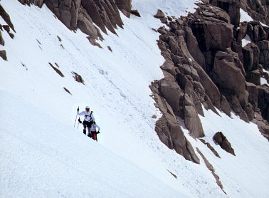
| Ascending Mt. Sill from the west |
Drop down the drainage from Southfork to Palisade Lakes. From the outlet of the northern Palisade Lake, go about 1/2-mile west and then ascend northward over the 12000' Cirque Pass. If skiing north-to-south, it is worth keeping in mind that there are some cliff bands if you don't go far enough west. Another option is to take a higher pass, 1/2-mile east of the 12000' Cirque Pass, at 12400' (this different pass is also commonly called "Cirque Pass"). Using the higher pass allows a traverse about 700' above Palisade Lakes; this higher "Cirque" may be your best choice in late Spring when the lower reaches of the lower Cirque Pass route start to dry up.
From either of the two "Cirque Passes", descend to the large lake at the head of Glacier Creek, Camp 2. This is a fine base camp for a day tour up two nearby 14000' peaks, Mt. Sill (you'll want to read the description of this peak tour in Paul Ritchens' guidebook), and Polemonium Peak (the last 100' is exposed class 4 rock work).
Continue from Camp 2 in a northwestern direction over the briefly steep ledgy Potluck Pass, and then traverse along the base of the North Palisade group to Thunderbolt Col, which is at the western base of Thunderbolt Peak. Continue traversing along the Palisades to Bishop Pass, and then descend to South Lake roughly via the trail route.
| |
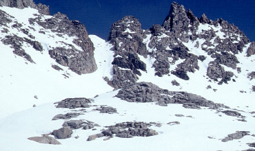
| Southfork Pass from the west |