

| |
| Whitney viewed from near Trojan Peak; that's Barnard's east slope to the right |
Day 1 is short, due to the need to acclimatize. Ascend west of south from Onion Valley towards University Col, the steep pass about a mile southeast of University Peak. Camp 1 should be somewhere along the way.
| |
| That big steep funnel is University Col (west side) |
Ascend the expansive Center Basin southward, and traverse up the ridge to the west of lake 12090', crossing the Sierra Crest over the rise about a half-mile northeast of Junction Peak (west of the steep notch known as Junction Pass). Drop into the slot east of Junction Peak, and descend to the bowl just north of Shepherd Pass, Camp 2.
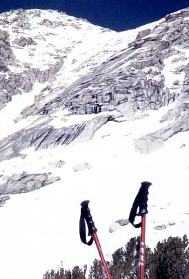
Today's another big day (if you or the conditions aren't ready for it, the Shepherd Pass trail can provide an easy bail-out route). Pop over Shepherd Pass and head southeast, between the towering summits of Tyndall and Williamson, to Lake Helen of Troy. Ascend and traverse around the west side of Trojan Peak (crossing very briefly over to the west side of the Sierra Crest and then back to the east side). Drop about 400' into the George Creek headwaters and then ascend Mt. Barnard's east face (which seldom holds snow) right to the top. From the summit of Barnyard, you can toss yer cowboy hat clear up to 14000', yessir. Then put that Stetson back on your haid and ride yerself one heck of a ski descent a half a vertical mile down, and that ain't no tall tale, to Wallace Crick. Camp 3, yeehaw!
An alternate route from Shepherd Pass to the southern base of Barnard is to go southwest from Shepherd Pass for about 2 miles, over a 12000' pass that takes you into the Wright Lakes area, continuing around Barnard's southwest side to Wallace Lake. We took this route in 4/02 to avoid poor snow coverage on Mt. Barnard. Unfortunately, the Wright Lakes route misses a crossing of the spectacular Williamson Bowl.
More excitement ahead... Ascend southeast to the very special Lake Tulainyo, and climb Russell-Carillon Col, which may be a very challenging ascent if there is still a lot of snow coverage in the steep upper section. Descend from the col via Carillon's steep southeast-facing slope (a little less steep if you mostly stay towards the east side of the broad ramp), which drops into Clyde Meadow. From there, follow North Fork Lone Pine Creek down, via that infamous narrow brushy ledgy section below Lower Boy Scout Lake, to the Whitney Trail and the trailhead.