

| |
| Half Dome from Snow Creek trail |
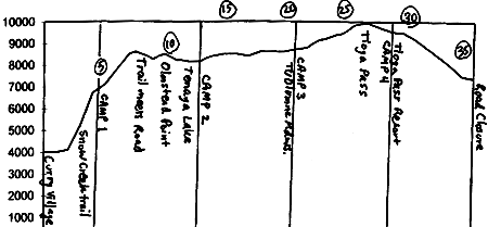
Hike out of Yosemite Valley via the Snow Creek trail, on Yosemite Valley's north wall, east of Basket Dome. Camp 1 is at the top of the trail where it starts to level out. Hopefully you have snow on the ground by now.
From the top of the Snow Creek trail climb, head north, then northeast, traversing the rounded ridge that lies 1 to 2 miles north of Mt. Watkins. You should reach Tioga Road about a half-mile to the west of the topo map boundary. From here, there are two options:

| |
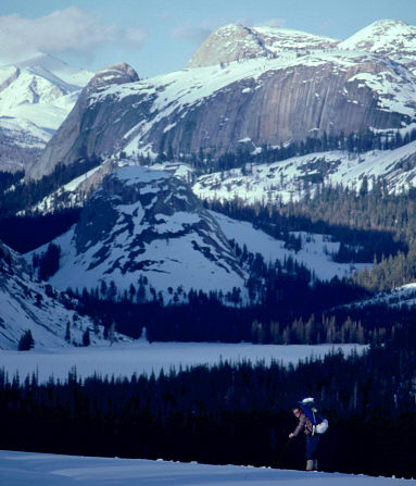
| Norman Herterich approaches Tenaya Lake from near Olmstead Point |
Follow Tioga Road to Tuolumne Meadows, Camp 3. Just before (west of) where Tioga Road crosses the Tuolumne River, there is a Park Service Ski Hut on the south side of the road. It sleeps about 6, and is available to skiers on a first-come-first-served basis (as far as I know). There's also a working payphone just outside. The wintertime Tuolumne Meadows rangers live nearby (if you plan ahead, you can leave a food stash with them before the winter).
Follow Tioga Road over Tioga Pass, and down the hill to Tioga Lake, Camp 4. Civilization intrudes yet again, here, at Tioga Pass Resort (TPR). Note that late-season (typically in April, about a month or so before the road is opened through the park), Tioga Road is cleared of snow and open to cars on the east side as far as Tioga Lake.
Assuming that the road is still closed down at 7400', and assuming that you aren't enjoying a hot shower at TPR, you have a long easy ski (and then hike) to the road closure west of Lee Vining (parking is available).
This tour is often done mid-winter, though it should still be in fine shape in the tamer climes of early spring. With an average elevation of just over 8000' the snowcover can get thin in places by mid-spring. However, once the eastern part of Tioga Road opens in April, you might consider a shorter ski trip into Tuolumne meadows, starting and ending just east of the pass.
General info and disclaimer about backcountry skiing